Project Leader(s)
Emily Lane
NIWA
Contributing Organisations


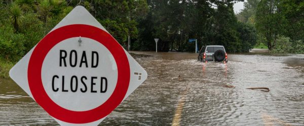
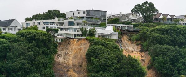
Cyclone Gabrielle caused widespread flooding over much of the North Island of Aotearoa New Zealand. The flood impacts were greatest in Hawke’s Bay and Tairāwhiti regions, including loss of life and significant damage to buildings, land, infrastructure and primary production.
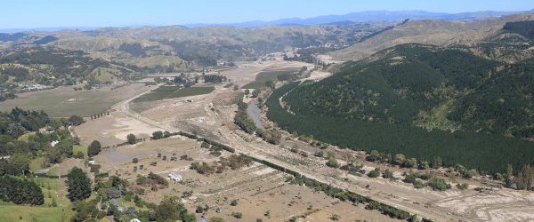
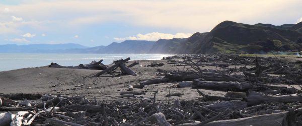
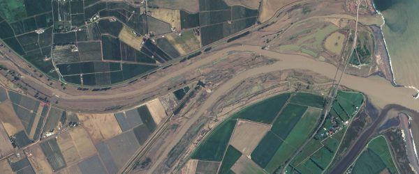
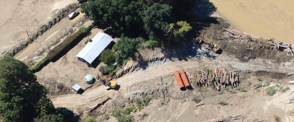
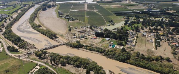
In addition to the flooding, landslides generated huge amounts of sediment that have significantly altered the landscape in many areas, depositing 1-2 metres deep of sediment over several locations including the Esk, Dartmoor and Tangoio Valleys. Initial estimates suggest more than 5.8 million cubic metres of sediment has been deposited in the Esk Valley alone. Even more of this landslide sediment still remains in the upper catchments and will continue to affect the rivers and their geomorphology for the decades to come.
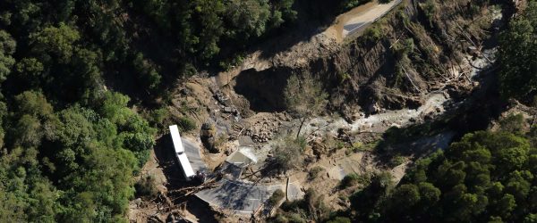
The amount of rain that fell during this event was a game changer. It exceeded the expected maximum rainfall amounts in many locations causing floods that overtopped the stopbanks in over thirty locations along the Tūtaekuri and Ngaruroro Rivers alone. The flood significantly exceeded the design specifications causing erosion on the outside edges of the stopbanks. Attribution theory suggests that climate change may have contributed 20-30% to the rainfall intensity in this event.
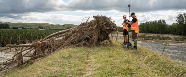
It is vitally important to understand what this event tells us about the likelihood of a similar event happening again in the near future, especially within a changing climate. Changes to the river beds due to the amount of sediment coming down the system will have altered the flood hazard in these rivers and will continue to do so for decades to come as the sediment makes its way down to the sea. This project will undertake an analysis of the Cyclone Gabrielle flooding and use that information to model what future extreme flooding might look like in the Hawke’s Bay and Tairāwhiti regions. It will look at how the sediment load in the rivers may have altered the effectiveness of the stopbanks and what might happen in the case of further stopbank breaches. This information will enable the district and regional councils, iwi/hapū and local communities to make informed decisions about their futures and to protect themselves in the event of flooding in the coming winter rainy season. This is urgent work because it will assist the district and regional councils respond as quickly as possible: to provide certainty to their residents, and inform emergency management and rebuild, repair or retreat.
We are working closely with the local councils (GDC and HBRC) to assess what the priority locations are, and to leverage off previous work. We are bringing together the expertise of NIWA, WSP and the Universities of Auckland and Canterbury, and will liaise with iwi/hapū, utilities providers, Civil Defence and Emergency Management users and central government agencies, as well as councils. In addition to the flood assessments, we will work to identify the next steps in ensuring Hawke’s Bay and Tairāwhiti regions are protected from future flooding and can build back with increased resiliency.
Related projects