Project Leader(s)
James Brasington
University of Canterbury
Justin Stout
University of Canterbury
Contributing Organisations


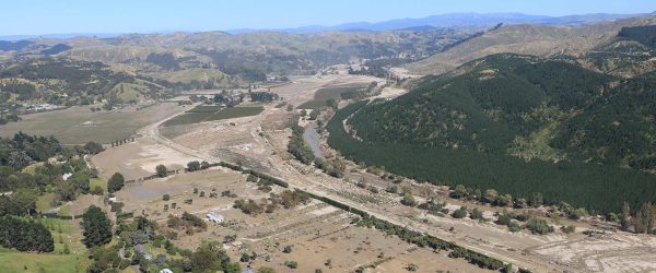
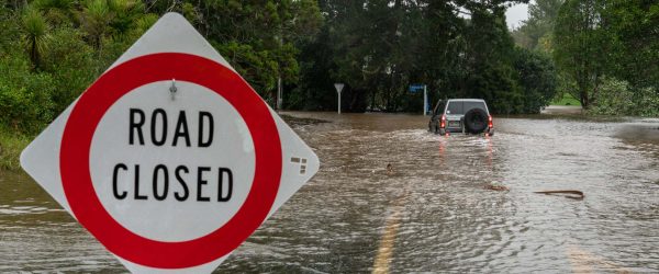
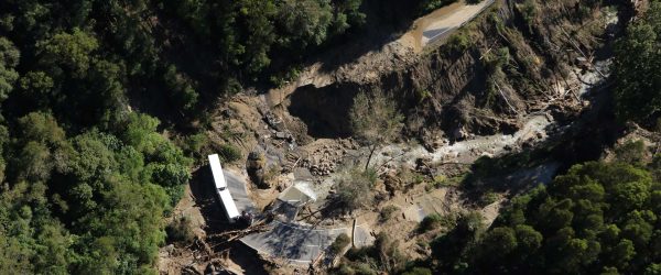
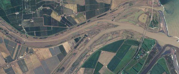
The week after Cyclone Gabrielle, the NIWA hydrodynamics team joined forces with the University of Canterbury and Christchurch Helicopters Limited. They mounted a LiDAR instrument (Light Detection and Ranging – a way of rapidly capturing topographic data to build a 3D map) on a helicopter, and used it to locate and document stop-bank breaches for the main Hawke’s Bay and Tairāwhiti rivers, and to identify the major flooded areas and sediment deposits.
The team also combined data on the extent of flooding from SAR (Synthetic Aperture Radar) and satellites. Analysis of the gathered information is ongoing, and ArcGIS software is being used to make data accessible and to help in future assessments of changes in river geomorphology due to the flooding.
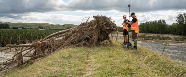
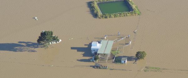
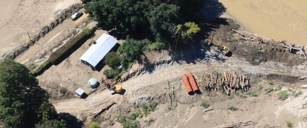
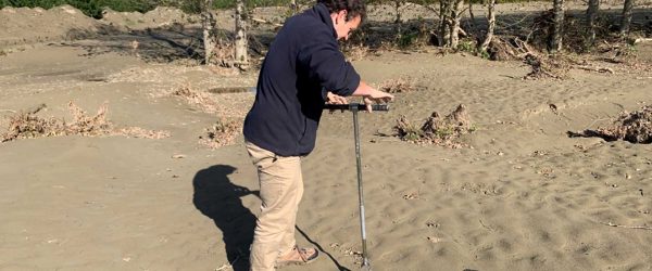
NIWA also undertook an on-the-ground field survey of flood levels and stop bank breaches at locations stipulated by Hawke’s Bay Regional Council. They surveyed the depths, extent and bank breaches for flooding from the Tūtaekurī, Ngaruroro and Esk rivers. The data they collected will be used for calibrating hydrodynamic models and ground-truthing the LiDAR surveys.
Related projects