Project Leader(s)
Murray Ford
The University of Auckland
Contributing Organisations

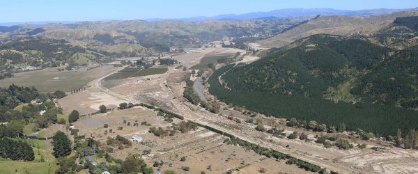
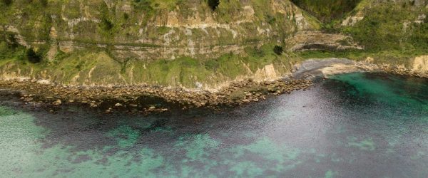
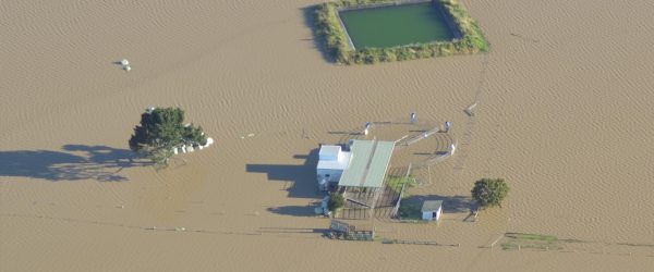
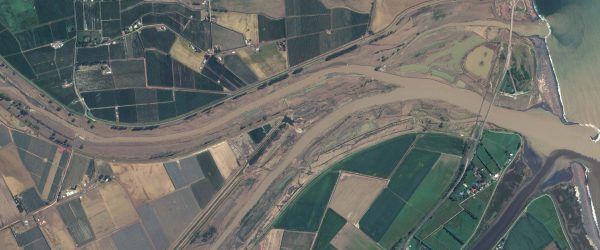
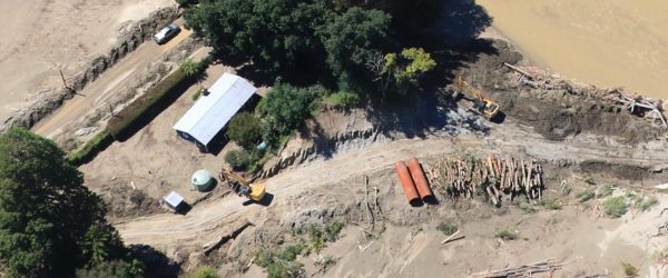
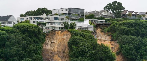
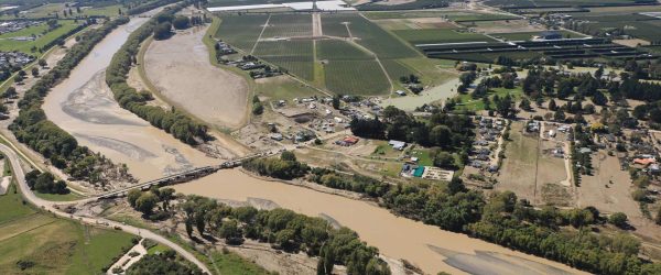
Cyclone Gabrielle generated massive swells which impacted the east coast of the North Island, resulting in notable erosion along the coast. Many east coast communities have developed on low-lying coastal barriers, which are geologically young landforms comprised of unconsolidated sands. These barriers are often fronted by a series of sand dunes which provide a natural buffer between the beach and the land behind. In places the dunes have been artificially compromised by land development practices and vegetation changes, reducing their protective capacity. Several reports following Gabrielle show widespread erosion of the foredune, the most seaward sand dune within the system. In places, the foredune resembled a 1-3 m high “sand cliff” as waves eroded the dune face. Likewise, observations suggest that beaches fronting eroded dunes have also lowered, increasing the susceptibility of the beach to further erosion. Evidence from past storms shows similar behaviour, and post-storm surveys have shown that beach and dune recovery from severe coastal erosion events can take decades. However, the recovery of beaches is uncertain given accelerating rates of sea level rise and potential for further erosion over winter when the coast is exposed to stormier conditions.
Several coastal communities, have seen the coast erode back into council reserves and encroach on private property. Immediate responses to the storm have included demands for protective measures, such as seawalls, and heightened awareness of planning strategies such as hazard setback zones and managed retreat. Short-term responses to Gabrielle and long-term planning decisions require a robust understanding of the Gabrielle’s erosional impact and needs to place those impacts in the context of decadal-scale coastal behaviour.
This project will leverage existing and ongoing work undertaken by the Resilience to Nature’s Challenges National Science Challenge (RNC2) . The ‘New Zealand’s Changing Coastline’ team will build upon their national scale coastal mapping programme to provide high-quality, timely and open data to understand the post-cyclone behaviour of the coast. Collectively these data are required to underpin discussions about medium and long-term planning and adaptation along the coast.
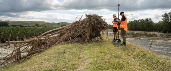
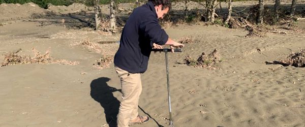
In order to achieve this aim, the project team will use a combination of field surveys to collect high-precision data on the state of the beaches, along with satellite data to map coastal change around most of the North Island’s east coast. Field surveys will precisely measure the topography of beaches, providing an understanding of beach change at ~10 highly-impacted beaches. In order to understand the impacts of Gabrielle across a broad spatial scale satellite imagery will be used to map erosion. Over the past three years the RNC2 New Zealand’s Changing Coastline project has been mapping coastal change around Aotearoa over the last 70-80 years. Using historic aerial photographs and modern satellite imagery, the RNC2 team has generated times series of shoreline positions around the country. Councils use these types of data to support planning along the coast, including developing coastal setbacks. These planning tools typically account for the rates of coastal erosion over both long and short-term and project them into the future using various sea level rise projections.
The proposed project will extend existing shoreline records, which are generally sparsely sampled through time, to include the impact of Gabrielle along with the ongoing changes in the 12 months following the storm. By integrating these new data with the multi-decadal RNC2 records it will be possible to place storm impacts into the context of several decades of coastal change and provide the foundation for on-going coastal change monitoring to inform decision making within existing and new planning tools.
Resource Outputs from this project
Presentation
Presentation slides from ‘Reducing Future Extreme Weather Impacts in Aotearoa New Zealand’ webinar
Webinar presentation slides presenting key findings from the Extreme Weather Research Platform (EWRP).
Webinar
Reducing Future Extreme Weather Impacts in Aotearoa New Zealand
Researchers from the Extreme Weather Research Platform (EWRP) present their key findings.
Data Set
Pre- and Post-Gabrielle coastline mapping data
View digitised coastlines from our Changing Shoreline project team, based on aerial photographs and high resolution satellite imagery taken prior to Cyclone Gabrielle, and after.
Related projects