Identifying data sources for hydrometeorological impact forecasts and warnings in Aotearoa New Zealand
By Sara Harrison
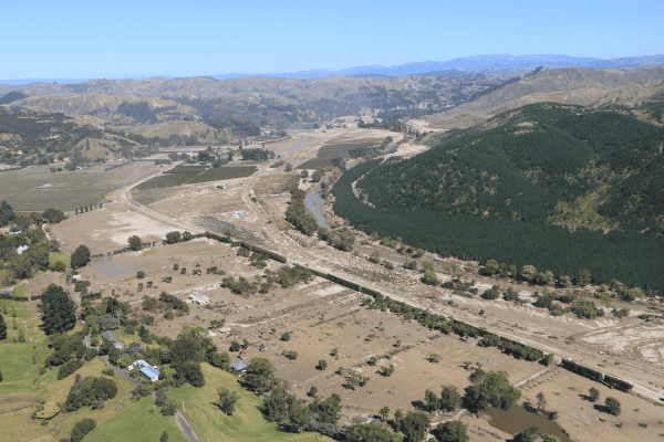
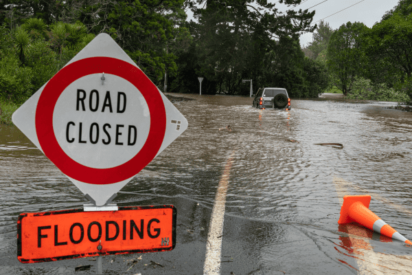
Severe weather warnings help us to prepare and take action to protect ourselves and our properties from the impacts of these hazards. Notable historic events both within and outside of Aotearoa New Zealand have revealed gaps in how these warnings are communicated to, and understood by, target audiences. Impact Forecasts and Warnings are a new warning system that has been proposed to address some of these gaps by communicating what the weather will do (i.e., the impacts), along with what the weather will be. This would add meaning to the warnings and enable audiences to make appropriate decisions to protect themselves.
One challenge with implementing Impact Forecasts and Warnings is the lack of understanding around the underlying causes of the impacts caused by the severe weather hazards. This makes it difficult for meteorologists and other warning service providers to adequately forecast impacts in addition to the weather hazards. More data is needed to build this understanding and forecasting capability.
In this study, we conducted a series of interviews with users and creators in New Zealand of hazard, impact, vulnerability, and exposure data to identify data sources and understand how these data are collected and created. We found that many sources of data are used for emergency/disaster response and research purposes (these are the causal conditions for collecting these data, as shown in the figure below), that could potentially be repurposed for Impact Forecasts and Warnings.
However, some barriers to collecting and using these data for Impact Forecasts and Warnings. These are the intervening conditions shown in the figure. For example, misdirected/conflicting priorities of upper management and lack of motivation or interest inhibit data collection efforts. Furthermore, the leading mandate of warning services is to preserve life and property through accurate warning messages. As such, they must be able to trust the data the use to inform their decisions. Consequently, there is a preference to use official data (such as 111 calls, wellbeing surveys, etc.) over unofficial data sources such as social media, crowdsourcing. However, some of these official data sources are not available in real-time, which is a critical need for updating warnings as the event unfolds. These unofficial data sources (e.g., social media and crowdsourcing) offer more timely data but are considered less trustworthy than less timely official data sources. Thus, a tension exists between the timeliness and trustworthiness of the data needed for Impact Forecasts and Warnings, requiring warning services and other relevant agencies to compromise between these two factors.
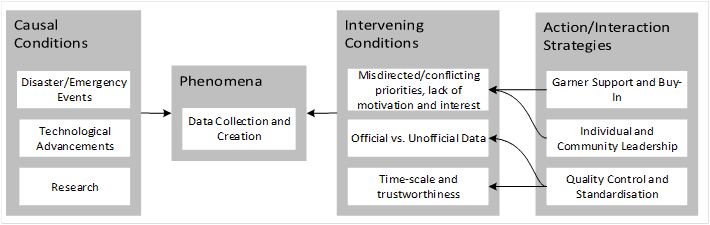
Strategies were identified to address these intervening conditions. These are the action/interaction strategies listed in the above figure. Garnering support and buy-in on a data collection initiative can help redirect priorities and rejuvenate motivation and interest. Leadership from an individual or a community such as the NZGIS4EM group can also help with priorities and motivation. Quality control measures and standardised data collection methods can also be used to improve the trustworthiness of unofficial data so that it more useful for use in an Impact Forecasting and Warning system.
Additional work built off of these interviews is exploring the how these datasets can be used for Impact Forecasts and Warnings (Harrison et al., Under review), and further challenges to accessing and using them (Harrison et a., Submitted). Publications of this work are forthcoming.
References:
Harrison, S. E., Potter, S. H., Prasanna, R., Doyle, E. E. H., & Johnston, D. (In Press). ‘Where oh where is the data?’: Identifying data sources for hydrometeorological impact forecasts and warnings in Aotearoa New Zealand. International Journal of Disaster Risk Reduction. https://doi.org/10.1016/j.ijdrr.2021.102619
Harrison, S. E., Potter, S. H., Prasanna, R., Doyle, E. E. H., & Johnston, D. M. (Under Review). Identifying the data uses and gaps for severe weather impact forecasts and warnings. Weather, Climate, and Society.
Harrison, S. E., Potter, S. H., Prasanna, R., Doyle, E. E.-H., & Johnston, D. (Submitted). ‘Sharing is caring’: A socio-technical analysis of the sharing and governing of hydrometeorological impact data in Aotearoa New Zealand.