What if ex-Tropical Cyclone Cook had hit Auckland?
By Dr Richard Turner
Many of the objectives of the Resilience Challenge Weather & Wildfire programme are highly dependent on creating ultra-high resolution, multi-hazard weather models. Part of the work involves the modelling of credible ‘what-if’ scenarios such as what if the path of ex-Tropical Cyclone Cook (which did much damage on the eastern Bay of Plenty coast) had been further west and hit Auckland.
To do this scenario modelling at such fine grid resolutions has not been done before in New Zealand and it will allow detailed impact modelling to be done for a variety of coincident weather, flood, and landslide hazards – building a credible worse-case impact scenario for Auckland and surrounding districts.
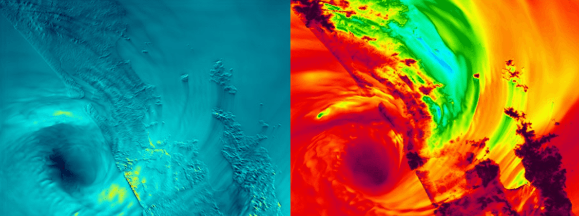
The example plots above are some early results for Auckland, with the centre of ex-Tropical Cyclone Cook clearly evident offshore to the west of Auckland. It is interesting to note the extreme gust speeds in other areas well away from Auckland such as the higher elevations of the Kaimai Ranges – simulated to be well over 250 km/hr. For some more detail on the background to the ex-tropical cyclone modelling project there is an interesting NZ Herald article from January 2020 that is well worth a read.
At a recent workshop, presentations on the weather scenario (cyclones, fire, and winter storm) methodology, weather models, flood models, RiskScape (impact modelling) and data-sharing protocols were provided to interested researchers and modellers (coast, flood, landslide, and i-tool developers) within the Weather & Wildfire programme. For more information on the weather scenario modelling, contact Richard Turner.
