By Dr Gabor Kereszturi, Massey University
New Zealand is not short of composite volcanoes that can produce volcanic hazards from a range of eruption styles, pyroclastic density currents, rockfall and ballistics, lahars, and flank collapses, among others. Based on the geological record, Mt Ruapehu and Mt Tongariro have produced many of these impactful hazards in their pasts, including larger-scale flank instabilities leading to far-reaching debris avalanches.
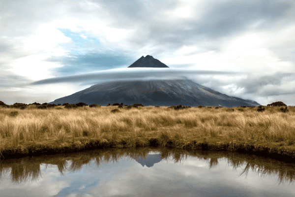
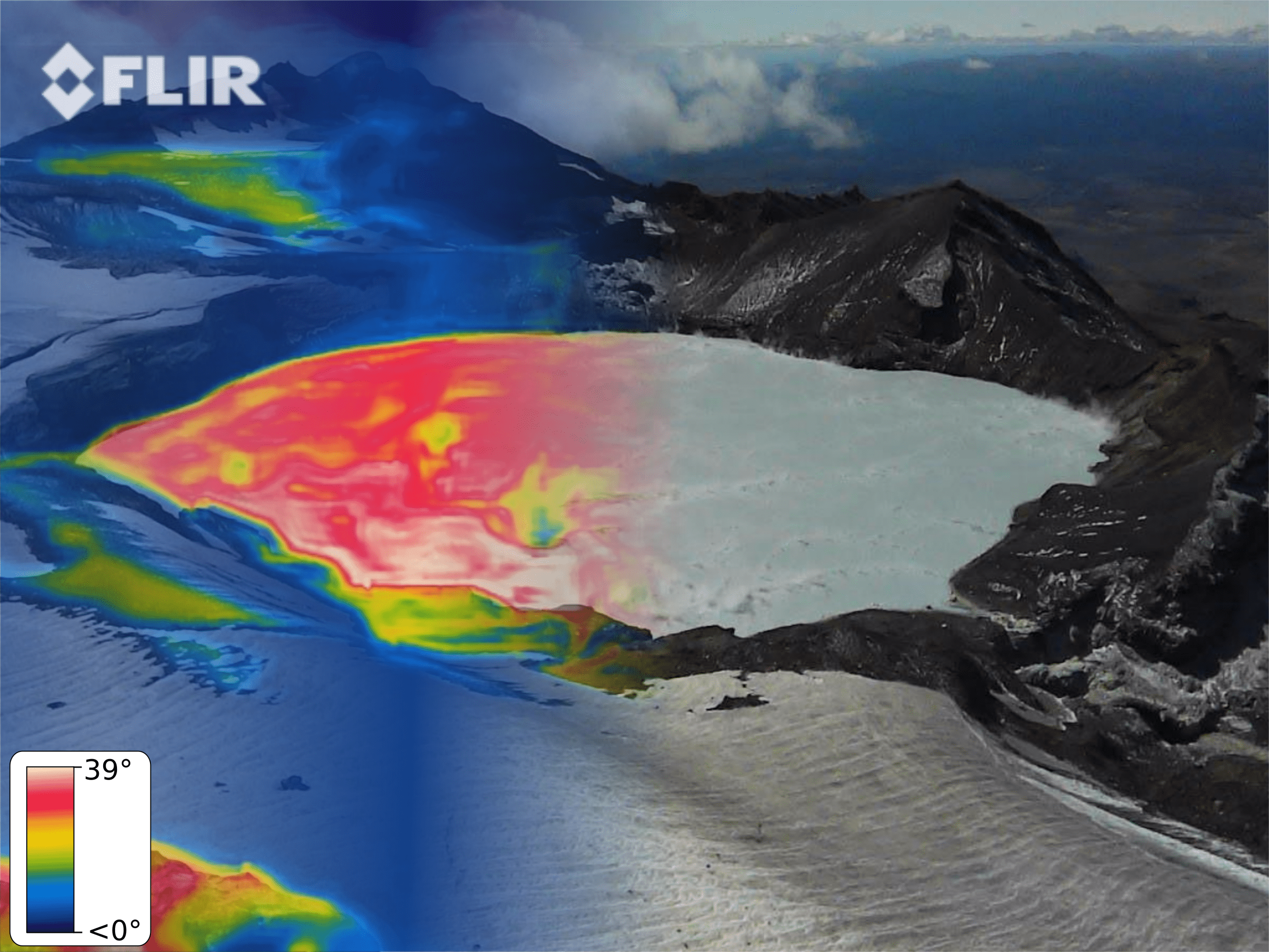
Flank collapses and instability are linked with hydrothermal alteration. Hydrothermal alteration is due to the circulation of hot and acidic fluids making their ways to the surface within a volcano. On Mt Ruapehu, this is often manifested as a heat-up of the Crater Lake (Figure 1) however, the current and past extent of such hot fluid’s pathways are practically unknown.
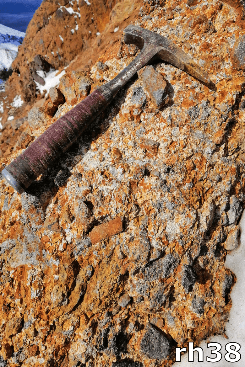
These fluids can change the primary physical and chemical characteristic (Figure 2), making it weaker and weaker over time. The mineralogical is spatially highly heterogenous, complicating our ability to quantify volcanic hazard around composite volcanoes.
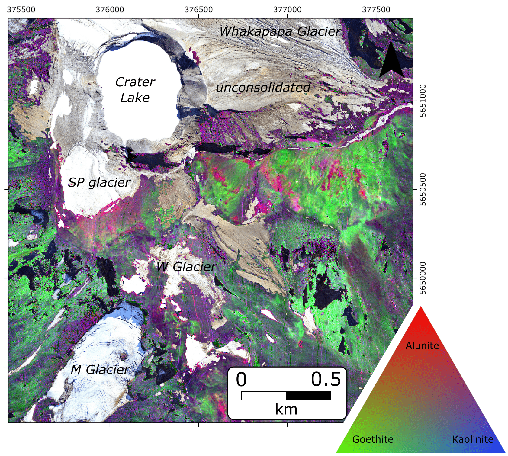
Hydrothermal alteration forms new minerals that can absorb light at wavelength beyond visible light. Hyperspectral imaging is a versatile technology that measures upwelling radiation from the surface of the Earth at hundreds of narrow and overlapping spectral bands.
When a hyperspectral sensor is mounted on a low-flying aircraft, we can acquire a seamless image with detailed spectral information associated with every image pixel. This wealth of spectral information can help to constrain the extent and type of dominant alteration mineralogy at every pixel, allowing a fast way to quantify the spatial patterns and degree of hydrothermal alteration on the surface of volcanoes.
New alteration mineral maps have been produced for Mt Ruapehu with this exciting technology for the first time, highlighting areas of intense alteration in the geological past (e.g. in purple in Figure 3). Our understanding of the evolution of such highly altered areas can vastly improve our capability to implement numerical modelling to forecast initiation and run-out distance of resultant debris avalanches that can travel 20-40 km from the volcanoes.
Hyperspectral scanning is, however, not limited to airborne, or satellite application. Still, it can be used in well-constrained laboratory condition, providing opportunities in the future to combine hyperspectral data with other datasets (e.g. engineering geology). This is a promising future research direction that can help better understanding hydrothermal alteration on volcanoes at a centimetre smaller scale, as opposed to the 1-10 meters resolutions of airborne and satellite hyperspectral images, respectively.
These new datasets can decipher how rock-mass behaves and change their mechanical properties with hydrothermal alteration, contributing to highlights areas of potential future failure zones on New Zealand’s most iconic volcanoes.
Dr Gabor Kereszturi was a recipient of a 2020 Rutherford Discovery Fellowship for his research on hyperspectral remote sensing of volcanoes.