Student Profile: Ameila Lin
16/04/2019
Seismic exposure and impacts across New Zealand infrastructure networks
 A bit about me
I was born in Germany, and I lived most of my life in Berlin. I received a bachelor and master’s degree in civil engineering from the Berlin Institute of Technology (TU Berlin). However, I spent a semester abroad at the National Taiwan University, where I first heard about disaster management. Growing up in a country where flooding is the main natural hazard, I became fascinated by earthquakes, tsunamis and tropical storms. That is why I decided to move to New Zealand and to start my PhD at The University of Auckland in 2017. Although I miss my home country a lot, I am very grateful for the amazing opportunity to learn new things every day and to do what I am most passionate about.
My project
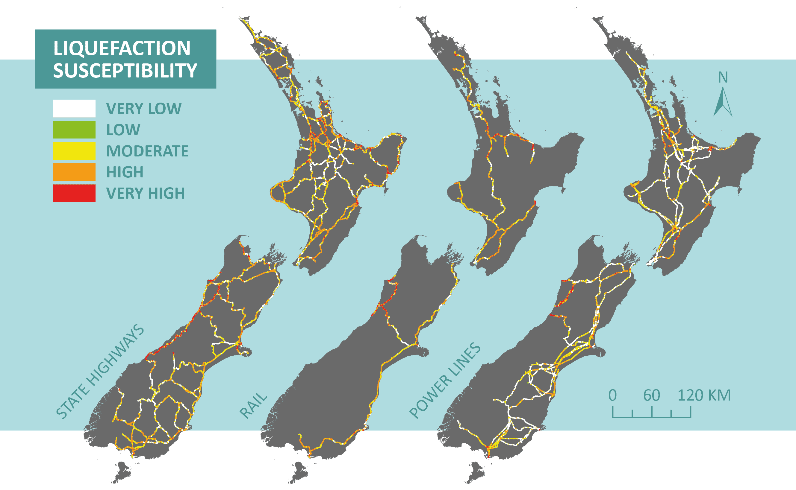
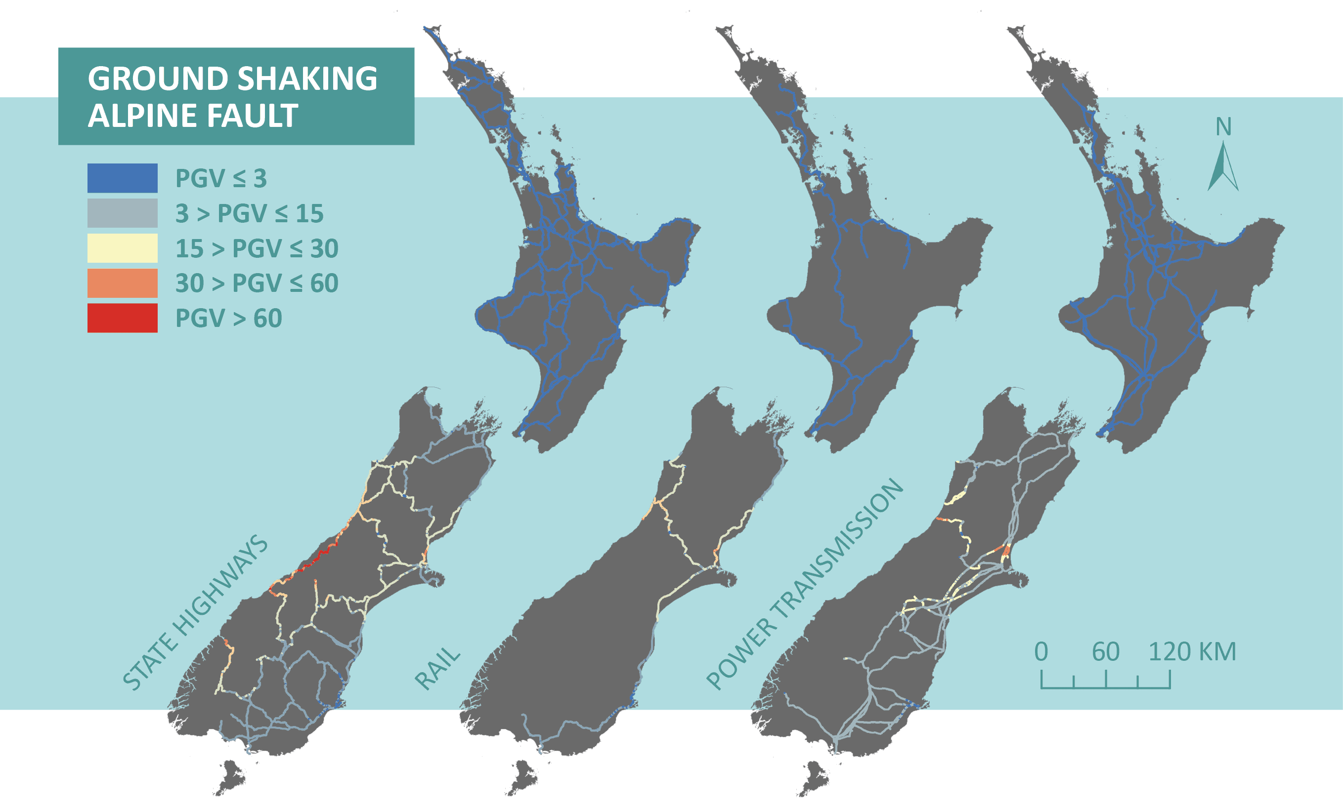
In the first stage of my research, I am looking at different infrastructure networks across New Zealand such as State Highways and power transmission, and developing a geospatial framework to analyse the extent to which they are exposed to ground shaking, liquefaction, and landslides. This links simulation of ground shaking across a range of potential earthquakes with application of geospatial methods for liquefaction and landslides and the location of New Zealand’s national infrastructure networks. Geographic information systems (GIS) will help me to understand and analyse the data, to identify trends, and to present my results.
In the second stage of my research, I look at infrastructure criticality, which will allow me to classify the importance of a network (or a network section) to the economy and society. This includes identifying indicators to quantify criticality, considering dependencies and interdependencies across all networks, and understanding the role of infrastructure services before and after a disaster event. All these processes are GIS based in order to directly link exposure and impact.
Once complete the outcomes of this research can be used to support decision making processes regarding site specific assessment of key parts of the networks, infrastructure resilience investments, and rapid response and emergency planning.
Next steps
At the moment, I am in the first half of my second year. I am still working on the seismic exposure assessment, and have just started working on network criticality. Once the geospatial methods have been developed, they can continue to be updated and improved as our knowledge across these hazards improves. There is a lot of ongoing research in this area that can be incorporated in the future. I will soon begin looking into a range of criticality aspects, including existing frameworks and inputs into these frameworks such as the movement of goods and people within the transport network, and the location and access to important facilities such as hospitals.
Given the range of approaches that could be taken, I hope to identify the influence of these on how infrastructure is classified and highlight any potential improvements in these approaches.
