Cyclone Gabrielle was a severe ex-tropical cyclone that occurred in February 2023. It caused severe landsliding in several zones along the east coast of the North Island. As part of the cyclone response, the Ministry for the Environment contracted Manaaki Whenua – Landcare Research to do a rapid assessment of the damage in hill country (Land Use Capability classes 6 and 7) resulting from the landsliding.
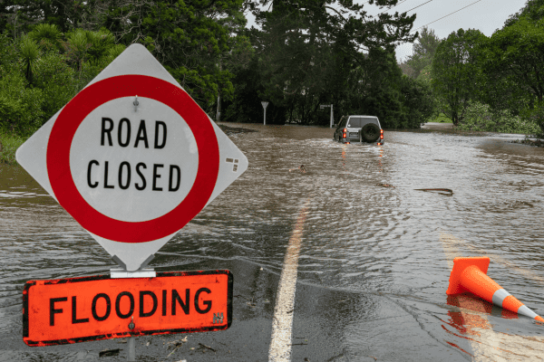
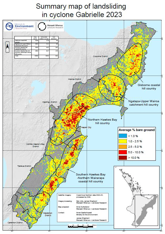
The extent of severe damage was large, ranging from the Gisborne district, through Hawke’s Bay, and down to the Wairarapa. Landsliding was most prevalent along the eastern coast of the North Island and severely affected seven districts: Carterton, Masterton, Tararua, Central Hawke’s Bay, Hastings, Wairoa, and Gisborne.
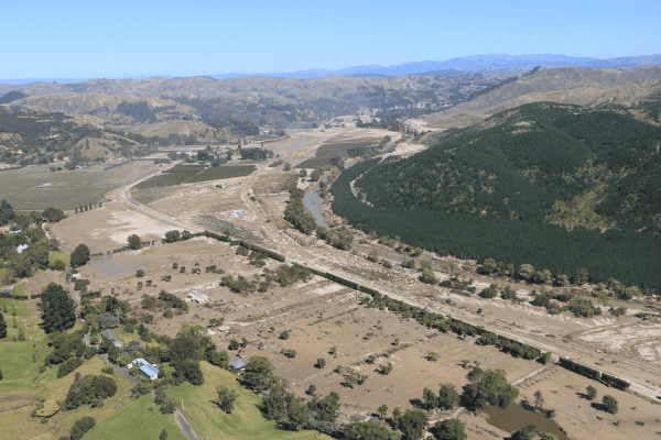
The total number of landslides, each typically comprising a thousand tonnes of soil, was over 300,000. This proliferation of landsliding has removed productive soil from farms and deposited sediment on floodplains. The total mass of landslides is estimated at 300 million tonnes, with an economic cost of approximately $1.5 billion (conservatively estimated at $5 per tonne of eroded soil).
Credit: Manaaki Whenua.
What causes landslides?
The physical mechanism for landslide initiation is well understood. Intense rainfall increases the pore water pressure in the soil, which reduces the effective weight of soil at the failure plane between soil and regolith. On steep hill slopes this often results in shear stress exceeding shear strength, causing slope failure. If there is woody vegetation growing on the soil, then roots growing through the soil/regolith boundary will increase the shear strength and reduce the probability of failure. These mechanisms are generally sufficient to explain the spatial distribution of landslides in Cyclone Gabrielle; that is, landslides mostly occur where intense rainfall has fallen on steep land without protective forest cover.
Protection offered by forest cover
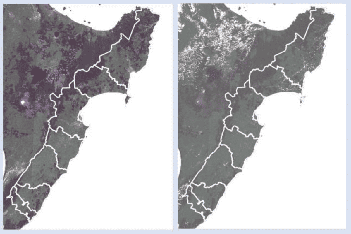
The reduction in landslide probability by woody vegetation is modelled at 90% by commonly used regional soil erosion models. In the southern Hawke’s Bay – northern Wairarapa hill country, this expected reduction was largely observed for both indigenous forest (90% reduction) and exotic forest (80%). However, in northern Hawke’s Bay, exotic forestry was less effective than expected (60%), while indigenous forest maintained normal reduction (90%). In the Gisborne coastal hill country, exotic forestry was ineffective at reducing landslide probability, with indigenous forest resulting in only a moderate reduction (50%).
Possible causes for the low effectiveness of exotic forestry for reducing landslide probability in northern Hawke’s Bay and Gisborne include:
- forestry management such as non-thinning
- multiple rotations of forestry
- thin soils caused by a long erosion history.
We recommend more detailed field investigations to determine specific causes.
Esk River Catchment
In the Esk River catchment approximately 5.7 million tonnes of soil was eroded by landslides. Half of that was delivered to waterways, of which approximately 1.5 million tonnes was deposited on the flood plain of the Esk River valley at an average depth of 80 cm. If soil conservation plans had been implemented on 50% of pastoral farms in the Esk catchment, the soil eroded by landslides would have been less, at 5.3 million tonnes. If soil conservation plans had been implemented on 80% of pastoral farms in the Esk catchment, the soil eroded by landslides would have been even less, at 4.7 million tonnes, and the sediment deposited on the Esk valley floodplain would have been less at 60 cm average depth.
Read the full report from Manaaki Whenua LAndcare Research here (pdf).