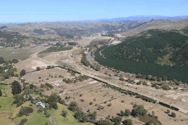
Cyclone Gabrielle was the largest landslide-triggering event on record in Aotearoa. Our response required development of new landslide mapping and modelling approaches in order to collate the landslide data. This novel approach provides stakeholders with a timely and sufficient level of spatial and positional accuracy about landslide occurrence and severity – where landslides could occur, did occur and might occur again in the future.
To date, over 140,000 landslides have been mapped from Cyclone Gabrielle. We believe this to be the largest known record of mapped landslides from a single event globally. Raw outputs from the survey have been available to stakeholders since the beginning of the project and are continually being updated. This has provided researchers and stakeholders with an invaluable dataset that can be used to retrain our hazard models and provide more accurate information about where landslides could occur in the future.
Focus has now turned to reviewing the outputs of the project and conducting Quality Assurance checks. Three publications are planned to document the the mapping and modelling work:
- a technical note focusing on the mapping methodology developed for this project,
- a publication presenting the dataset (close to completion), and
- another publication focusing on the risk and impact.
Upon completion of the project there will also be further report documenting two case studies (Tokomaru Dam and Piha), as well as a report on the Gabrielle Landslides emergency response.