A key part of our mission to accelerate natural hazard resilience is development of new models and tools to quantify natural hazards and their associated social and economic impacts in more detail, allowing for better assessments of resilience options.
As highlighted in our 2019-20 reporting, our Earthquake & Tsunami team have successfully developed a prototype of their ground-breaking synthetic earthquake catalogue.
The team starts with a 3D model of Aotearoa New Zealand and its faults, then uses computer calculations to simulate forces that cause earthquakes. When the forces acting on a fault overcome its strength, this triggers a ‘synthetic’ earthquake. Researchers can then see how the synthetic earthquake redistributes stress onto nearby faults and leads to subsequent earthquakes.
As well as feeding into analysis and advice during the March 5 tsunami response (see Impact Case Study: Responsive Science for National Emergencies), the catalogue has been used in numerous other applications. For example, the team used an M8.5 Hikurangi subduction zone earthquake from the synthetic catalogue to test the ability of an instrumented submarine telecommunications cable running from Napier to Chatham Islands to deliver tsunami early warnings for large Hikurangi earthquakes. This work was done in collaboration with a working group of the Joint Task Force on Smart Cable Systems. Bill Fry has provided advice to MBIE and EQC on the impacts of the proposed cable.
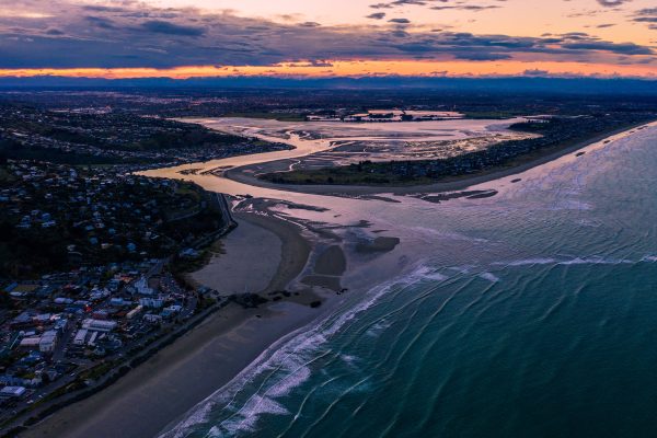
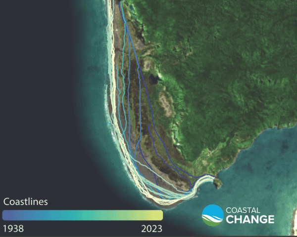
Pillar One of our Coastal programme involves creating a national coastal-change database to record a sequence of detailed snapshots of Aotearoa New Zealand’s entire 15,000 km coastline. The objective is to identify how fast our coastline is changing, and which areas are most prone to erosion. The work is complete for Northland and the database is being used to inform coastal spatial planning in the region.
While analysing Southland’s coastline, the University of Auckland’s Dr Murray Ford and his team identified a rapid rate of change adjacent to the Tiwai Pt aluminium smelter toxic waste storage facility. Dr Ford told RNZ: “Over the last decade or so the behaviour of that beach has changed. We’ve seen 30 to 40 metres of erosion since about the year 2010.” The sea is now just 75m from the concrete pad storing 180,000tonnes of waste laced with cyanide and toxic fluoride.
In the course of this research, Murray and his team have been able to raise awareness of a previously unknown and urgent problem.
In December 2019, the Wellington Lifelines Group delivered their Regional Resilience Project report, identifying 25 key infrastructure projects needed to boost resilience in the region over the next two decades, at a cost of $5.3b. The report relied heavily on economic modelling using MERIT (Measuring the Economics of Resilient Infrastructure Tool), a tool developed under Phase 1 of the Resilience Challenge and a key part of our Phase 2 Multihazard Risk programme.
The Wellington Regional Resilience Project was Highly Commended in the Collaboration category of 2021 Emergency Management Awards. Judges recognised ‘a true collaboration of Central Government, Local Government and all of the Wellington Lifelines Group members with private enterprise to deliver what has been recognised as a world-leading approach to infrastructure resilience analysis.’
The MERIT team has also been recognised in the 2021 Lloyd’s Science of Risk Prize.The team placed second in the Pandemics category for their work on ‘Accounting for business adaptations in economic disruption models’.
The capacity for businesses to adapt in the face of adversity has been demonstrated through the Covid-19 pandemic, and the inadequacy of economic modelling tools to account for this adaptation is shown in economic losses and business closures significantly lower than predicted. The team’s research is the first of its kind to build an empirically-derived model of business impact and recovery following disruption. The research has important implications for the insurance sector, because for insurers to maximise their capacity to support organisations through crises, risk models need to account better for the capacity of businesses to adapt.
MERIT analysis was also central to a technical report prepared by our Multihazard Risk team for Hawke’s Bay Regional Council, assessing water demand under climate change. The work uses the Dynamic Economic Model (a component of MERIT), various greenhouse gas trajectory scenarios, and independently developed water accounts to project water demand for the region. The work represents the first attempt undertaken in Aotearoa to assess future water requirements under climate change.
This case study was submitted to the Ministry of Business, Innovation and Employment as part of our 2020-21 annual reporting.
Featured image: Credit Graham Hancox, GNS Science
