Over the last ten years of RNC funding, researchers from our Volcanoes team have developed strong relationships with iwi partners and other important stakeholders in both Taranaki and the Central Plateau. There are numerous work programmes underway in both regions where our science can feed directly into emergency planning, public education, and other processes.
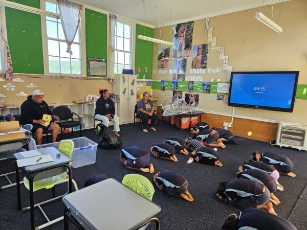
In October 2022, our team co-led a Coordinated Evacuation Hui at the Taranaki Emergency Management Office, with key stakeholders, the Taranaki Civil Defence Group, and other important partners including NEMA, Fire & Emergency NZ, Department of Conservation and Police. This was a great opportunity for the team to build on previous engagement and direct their research toward useful and useable outcomes for emergency management practitioners. Ongoing work includes developing a suite of dynamic evacuation scenarios for the region and identifying evacuation decision-making tipping points.
During the last quarter, the team has also worked with the Department of Conservation to support the development of the department’s emergency response plan in the event of an eruption of Taranaki Mounga.
Kristie-Lee Thomas of the University of Canterbury (supported by Prof Tom Wilson and Prof Jon Procter) is working with Te Āti Awa to provide high-level science information to support the redevelopment of the North Egmont Visitor Centre, at 978m on the north-eastern slopes of the mounga. This project involves supporting local iwi to reconnect with their whenua and tīpuna by constructing a new wānanga centre that is also informed by appropriate hazard information.
In central North Island, research outputs are communicated regularly with end-users through the Central Plateau Volcanic Advisory Group and through other meetings and direct interactions. In particular, MSc student Charles Ching’s research on Ruapehu crater lake colour was valuable to GNS Science and GeoNet for their monitoring of the Ruapehu Volcano unrest in 2022, as well as to the Department of Conservation and iwi in interpreting and managing the unrest.
Our Rural team provides science support to the Alpine Fault earthquake preparedness and response planning programme AF8 (Alpine Fault magnitude 8), a cross-boundary organisation funded by six South Island CDEM groups, QuakeCoRE and Toka Tū Ake EQC. This year, Assoc Prof Caroline Orchiston and AF8’s Alice Lake-Hammond have provided science support for a Taumata Arowai exercise scenario. The new water services regulator is developing a South Island Alpine Fault exercise, with the aim of understanding consequences for community access of safe drinking water following a major earthquake. In an October webinar with exercise participants, members of the AF8 science team presented the Alpine Fault scenario, its impacts and consequences, and provided context and guidance for the exercise.
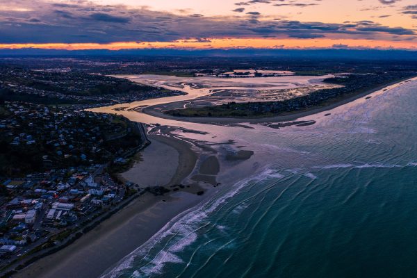
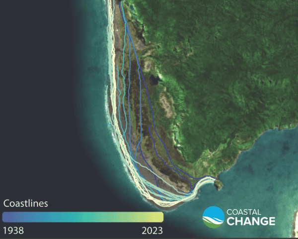
Our Changing Coastlines team have made data from their coastal mapping project publicly accessible via data.coastalchange.nz. There have been 883 views and 22 downloads of data from the Coastal Change website since 9 March 2023.
South Taranaki District Council and New Plymouth District Council are using data from the Changing Coastlines mapping project in their adaptation planning work. In addition, consulting firms Jacobs, Tonkin and Taylor and 4Sight have all requested and used our coastal change data from Pakiri Beach north of Auckland, for use in their contributions to and evidence for an Environment Court hearing.
In September 2022 the revised National Seismic Hazard Model (NSHM) was released by GNS Science. An important part of New Zealand’s hazard-scape toolkit, the NSHM provides an estimate of the likelihood and strength of earthquake ground shaking at any given site in New Zealand, and considers how different parts of the country might behave in the event of large magnitude earthquakes. This information is used by government and industry to help manage risks from seismic events and improve national resilience.
Our Earthquake-Tsunami team contributed some of the underpinning science for the revised model. New knowledge derived from our synthetic earthquake catalogue contributed to the NSHM team’s understanding of the relationship between large subduction earthquakes and co-seismic triggering of crustal faults.
Modelling work led by Dr Garry McDonald of our Multihazard Risk programme is supporting climate mitigation activities led by Auckland Council. In the latter half of 2022, Garry developed a Consumption Emissions Calculator for Council that will be used in various programmes including Future Fit, and the global C40 Cities reporting that Council is part of.
The modelling approach used in the team’s Consumption Emissions Modelling report for Council has been endorsed by the Ministry for the Environment in their 2023 Measuring Emissions: A Guide for Organisations.