
By Lisa Langer and Alison Brown, Scion
Wildfire frequency and severity are accelerating globally, including in Aotearoa New Zealand, due to climate change and development on the urban fringe. Scion’s wildfire researchers have, over many years, been working to understand where the risk of wildfire is increasing, where communities are most exposed, and how best to communicate and mitigate those risks.
Case studies involving communities in wildfire-prone areas, such as Mt Iron, Wānaka and Lake Ōhau, demonstrate the importance of awareness and mitigation guidance to support residents to reduce their risk and be better prepared in the event of a serious fire. Recommended mitigations have been summarised in an easy-to-use and accessible resource, Wildfire Mitigations for Homeowners and Communities.
The research was jointly funded by the Resilience to Nature’s Challenges National Science Challenge, the Sustainable Land Management and Climate Change (SLMACC) fund, and Fire and Emergency New Zealand. Led by social scientist Lisa Langer, it identified that awareness campaigns will not be enough to spur people into action. Most engagement surrounding wildfire comes too late—long after housing developments have been designed, homes have been built, and landscaping planted—when many of the factors affecting risk have become entrenched. This makes it complex, costly and sometimes impossible for homeowners and communities to mitigate their risks retroactively.
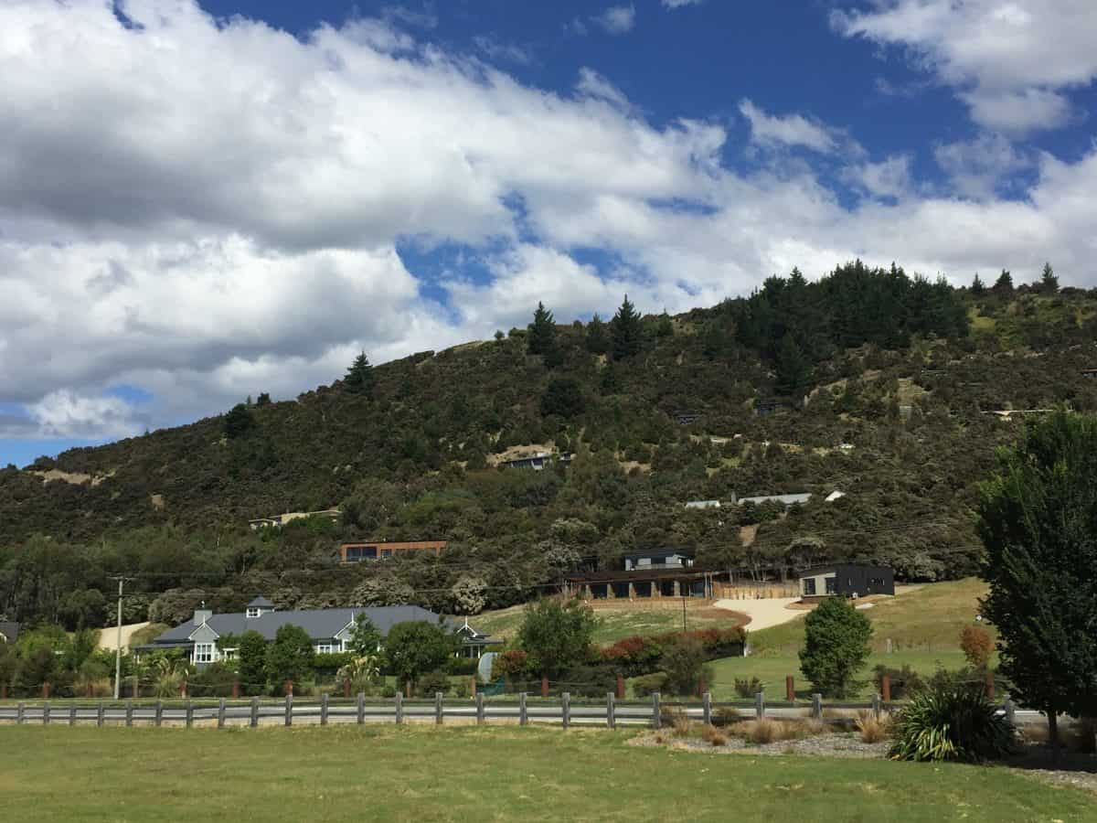
As an example, some Mt Iron community properties are located up narrow steep roads without alternative evacuation routes (Figure 1). In addition, they have restrictions that prevent them from removing the protected but highly flammable kānuka vegetation around their properties. This community’s difficulties have led us to shift research attention from addressing existing wildfire risk to ensuring that homes are built in ways that avoid or reduce risk from the start. This requires changing focus from individual homeowners and communities to the professionals involved at each step of residential development.
Scion and its international collaborators (US Forest Service and RMIT) and national collaborators (Institute of Geological and Nuclear Sciences (GNS Science) and Canterbury and Massey Universities) are undertaking research focused on improving New Zealanders’ understanding of how to learn to live with wildfire by connecting national to household-scale planning for increased wildfire risk. This research is part of the five-year MBIE Endeavour programme funded Extreme Wildfire programme.
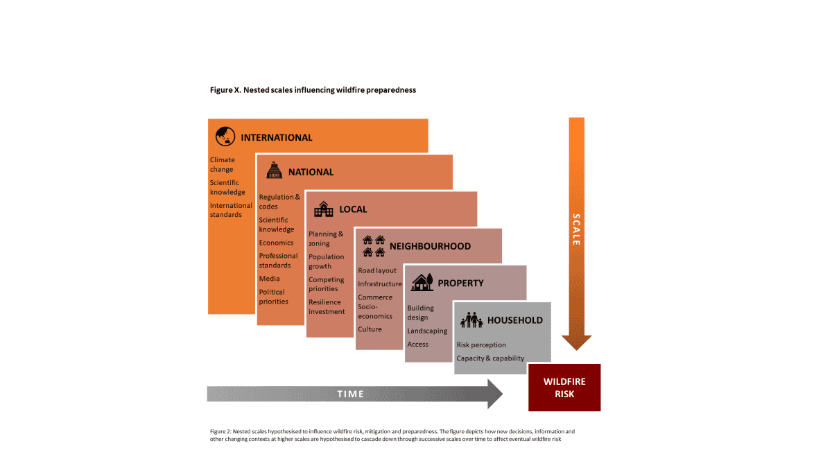
The team is investigating how decisions made throughout the planning, design and construction systems lead to homes being built with wildfire risk. The research is exploring how chains of decisions upstream create cascading contexts for decisions at each following step, ultimately shaping community and homeowner risk.
Integrated multi-scale, top-down wildfire research on planning and design of residential housing developments in the urban fringe has never been done in New Zealand before (Figure 2).
This MBIE-funded research is exploring challenges relating to New Zealand’s planning and building regulatory system and seeks to understand why uptake of wildfire-smart planning practices, materials and development designs appears low. It is also identifying critical intervention points to improve uptake of wildfire science for the benefit of communities downstream.
Working top-down from the national scale, the research is investigating decision-making at key steps using scenario-based workshops. Forty-five professional local government and private company planners, climate change/risk advisors, transport and geotech engineers, architects and landscape architects participated in five Scenario workshops in Wellington (2), Christchurch (2) and Nelson (1) in March. Participants were informed that the workshops were focused on natural hazards but were not aware that they were to explore professional considerations of planning and decision-making for wildfire risk within housing development within Aotearoa New Zealand.
Canterbury, Massey and RMIT Universities have trained a third of the workshop participants using immersive technologies (Virtual Reality), while another third experienced more traditional video tutorial training presentations, and the remaining third received no training. A similar number of professionals who did not participate have been selected for further comparison to determine the impact of different training styles on knowledge acquisition, and participants who received training will be tested on their retention of knowledge. The objective of the research is to understand the extent to which recent science about wildfires is incorporated into the decisions made by planning and design professionals, and how the uptake of wildfire-smart planning practices could be improved through different training techniques.