The AF8+ scenario
24/10/2018
By Tim Davies
The beautiful mountain ranges and spectacular scenery of New Zealand’s South Island can be largely attributed to the many active fault lines running through the island. When these move, in occasional response to the inexorable creep of the Pacific and Australian tectonic plates, the landscape changes shape, and over millions of years this has given us our visually stunning landscape. However, the process is ongoing, and every now and then an earthquake changes the landscape again.
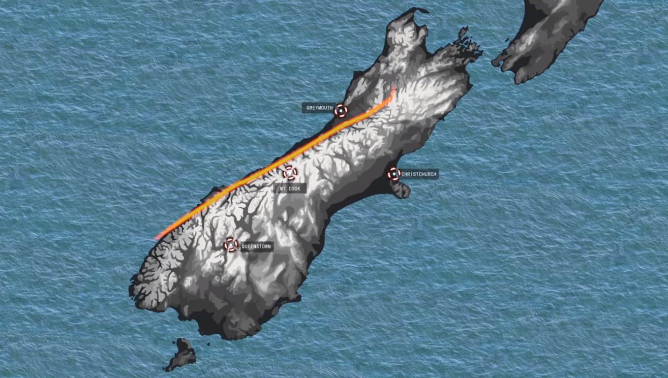
One of the largest of these faults is the Alpine Fault, which runs along the west coast of the South Island; it marks the currently-locked boundary between the Australian and Pacific tectonic plates, and the long-term displacement along this boundary has given rise to the Southern Alps. This fault carries most of the island’s plate boundary strain, and as a result it has a long history of ruptures, several each millennium, each producing a magnitude 8 or so earthquake. The next quake of this size will have devastating consequences for much of New Zealand’s South Island, and flow-on affects for the entire country. In light of this, a South Island-wide Alpine Fault earthquake planning initiative has been developed. Led by the six South Island Civil Defence Groups and co-funded by the Ministry of Civil Defence, Project AF8 is developing a scenario-based response plan for the seven days following the earthquake, based on the latest research in earthquake science. Find out more about Project AF8 here.
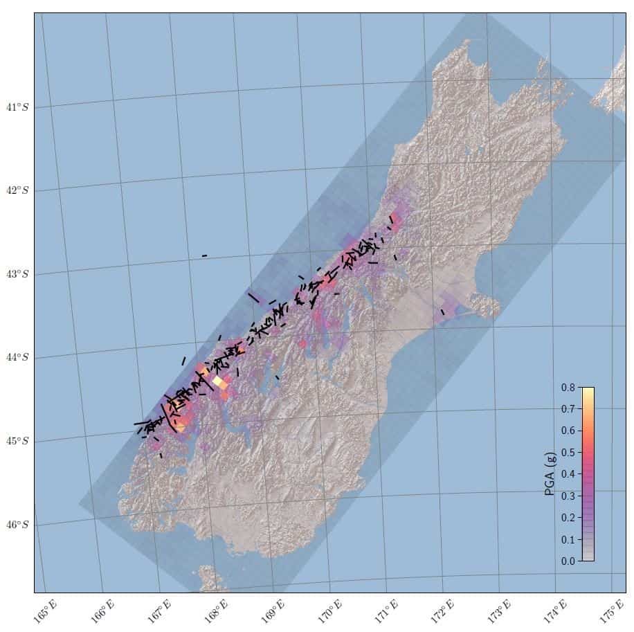
Researchers in the Resilience to Nature’s Challenges Hazard Toolbox have been working to extend Project AF8’s 7-day hazard impact scenario out to 10 years post-quake, in order to assess the longer-term impacts that may constrain response to and recovery from the event. Known as the AF8+ Scenario, this project is developing an understanding of the several different impacts – some long-term – that will affect assets and infrastructure after the quake, and their subsequent recovery over the decade that follows. The AF8+ scenario differs from AF8 itself in having a more realistic aftershock (Fig. 1) and landslide sequence, because AF8 had aftershocks and major landslides within the 7 days in each CDEM Group area. It also has a realistic post-quake weather sequence, identical to the 2006 – 2016 weather sequence, whereas the AF8 scenario had a 50-year storm 3 days after the mainshock.
The use of scenarios to inform planning for future events is becoming common worldwide, as a complement to disaster risk reduction. A scenario has no probabilistic component, meaning it can be understood by non-technical personnel and all stakeholders can be equally informed in contributing to planning for impact reduction. Nevertheless, it is important to note that a scenario does not represent what will happen in the future – it is a good example of the sort of thing that can happen. Hazards impact societal functioning by causing things like isolation, loss of lifeline services, deaths and injuries, and these effects don’t depend critically on the exact type or intensity of hazard event. Communities need to develop resilience to these hazard impacts, not to the hazards themselves. Thus the scenario is simply one of many starting-points for developing knowledge about societal impacts, and its specific details should not be the focus.
What would be affected?
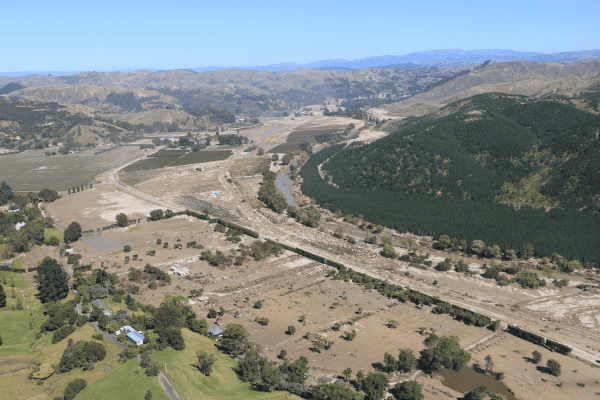
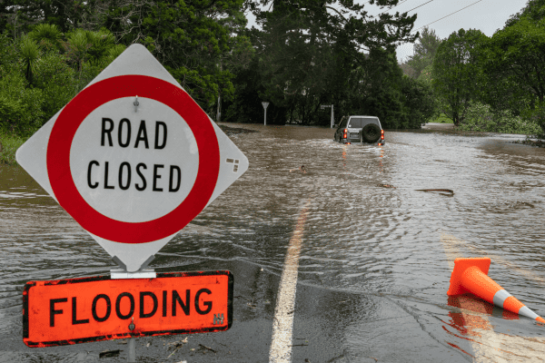
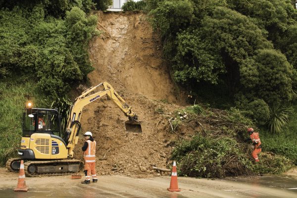
A magnitude 8 quake along the Alpine Fault (or on any other major fault or combination of faults) will have direct effects on infrastructure networks throughout the South Island. For example, ground shaking can damage electrical substations and powerlines throughout the island. In addition, as seen in the 2016 Kaikōura quake, the earthquake will trigger landslides that block and damage roads, railway lines and other transport infrastructure such as bridges and tunnels. These landslides may also generate tsunami if they fall into lakes or fiords. In the longer term, aftershocks will continue to disrupt recovery work. Earthquakes and landslides will deposit large amounts of sediment into waterways, and the effects of this appear likely to continue for decades – well beyond the timescale even of AF8+. This latter aspect is being explored in Jess Blagen’s University of Canterbury PhD, involving a dendrochronological study of aggradation pulses on the West Coast lowlands over the last 1000 years.
When one fails, others are cut off too
One of the major considerations in response to the AF8+ scenario is the interdependent nature of infrastructure networks. If one network is knocked out, others are often disrupted too. For example, if transport infrastructure in an area is damaged, repair of other infrastructure will likely be delayed as maintenance crews aren’t able to get to the water pump station or telecommunication tower to fix it. This interdependence can compound the effect of a hazard event, as infrastructure network failures, like natural hazards, can occur in cascading fashion, which in turn hinders and complicates recovery of those systems. The AF8+ scenario, in conjunction with the National Interdependent Infrastructure model, will shed light on the complex interactions that can take place within and between both types of network, and model the recovery process. Ali Davies’ PhD at University of Canterbury has focussed on working with infrastructure providers and the Franz Josef community to relate post-quake community needs to post-quake levels of service.
Keeping the lights on
One of the focus areas for the AF8+ scenario’s work is electricity infrastructure. Almost every other infrastructure network relies on electricity to function, meaning prolonged and widespread power outages would have significant impacts on response and recovery across the board. The AF8+ scenario is being used to assess a new electricity resilience framework, including the development of new methods to manage the power system that will allow for its rapid restoration if (or when) major parts of the West Coast are cut off.
The scientist – community – practitioner collaboration
The outcomes of this project will be used to guide recovery planning for a large earthquake event in the South Island. Based on experience gained during AF8, the extended AF8+ scenario will provide a basis for the development of long-term resilience-focussed collaborations between Civil Defence, lifeline organizations, communities and scientists both on the West Coast and across the South Island. This in turn will provide a tested model for the rest of New Zealand, which can be exported to the world.
Project outcomes
Once completed, the AF8+ scenario will help to guide and assess pre- and post- event investment decisions. Having a broad understanding of the likely nature and duration of hazard impacts allows all groups within society (officials, infrastructure providers, emergency managers, civil and commercial organisations and communities) to assess the impacts that the AF8 event and its natural system consequences will have on them, and start to develop plans for both reducing the severity of the impacts by pre-adaptation, and for managing the impacts better when they do occur.